History of The Crossings
|
History of Hampshire County and The Crossings at the Great Cacapon Compiled by Darline DeMott; revised by Gary Hillmar, 2023
A New Virginia County The formation of Hampshire County was authorized by an act of the General Assembly of Virginia, passed on December 13, 1753, effective May 1, 1754. Up until this time all of the South Branch, Patterson Creek, New Creek and Capon River valleys had been part of Frederick County, Virginia, which had been formed from Orange County in 1738. All of the area was part of the Northern Neck of Virginia belonging to Lord Thomas Fairfax. He and the settlers in the remote sections were eager to have a new county created so it would bring the seat of justice closer to the people. Before the creation of Hampshire County, Winchester was the county seat for the entire area. Also, a county government on the South Branch would make it easier to defend the frontier against the Indians, who were coming across the western mountains and marauding the country at the beginning of the French and Indian War. Therefore, it was not difficult to persuade the General Assembly of Virginia to create Hampshire County out of that part of the county of Augusta which lay within the Northern Neck and from a part of Frederick County. Also provided for in the act was the establishment of "the parish of Hampshire," and for the election of "twelve of the most able and discreet persons of the said parish, to be vestrymen." Twenty years later the inhabitants of Augusta and Botetourt counties complained to the general assembly that they "laboured under many inconveniences by reason of the great extent of the said counties and parishes," and asked for a reforming of the boundaries. Thus, in 1777, the boundaries of Hampshire were extended to include all of the present counties of Mineral, Hardy, and Grant, as well as portions of Morgan and Pendleton - an area of 2,800 square miles with an estimated population of between 3,000 and 4,000 persons. The earliest Hampshire County Court, of which the official records have been preserved, convened about five miles north of Romney (then known as Pearsall's Flats) on June 11, 1755, presumably in the home of some justice. The presiding justice of the first county court was Thomas Byran Martin, a nephew of Lord Fairfax. Under the act establishing the county, the first session of the county court should have been held in June of 1754. It could be that the court met then but that the records were lost. Also, it could be that the meeting was never held because of the trouble with the French and Indians who were making raids in the valleys of Hampshire. There are no records of the court for two years after June 1755. This period covers the worst of the Indian incursions into Hampshire County which caused many of the inhabitants to leave their homes and flee to Winchester, Virginia. Concerning their departure from the valley, George Washington at Winchester, in a letter of April 24, 1756, to Governor Dinwiddie of Virginia, says "the inhabitants are removing daily, and in short time will leave this county as depopulated as Hampshire where scarce a family lives." Hampshire County was so named by Lord Fairfax, who once observed a drove of fine hogs at Winchester - and upon learning they were from the Branch of the Potomac, remarked that when a new county was formed to the west of Frederick and including the South Branch, it should be called Hampshire for the English county famed for its fine hogs.
Early History of the Area References in history to what is now Hampshire County date back more than two centuries to 1725 when the first explorer, Indian traders, and hunters traversed the area. It was their glowing reports of fertile valleys, spreading forests, and navigable waters that encouraged five families to settle along the South Branch River before 1735, near the present town of Springfield. By 1740, nine families had formed a growing settlement, which by then was known as Pearsall's Flats, now Romney. Besides being unclaimed by the Indians and off the direct path of the warrior tribes on the Ohio, the surrounding territory offered many natural advantages; the fertile soil, grass and peavine covered terraces were well adapted to tobacco growing and stock raising - a consideration of primary importance to the pioneers - and by 1748, nearly 200 persons had moved into Pearsall's Flats and surrounding neighborhoods. Reports of the advancing settlements soon reached Lord Fairfax at Greenway Court, 46 miles away at Winchester, and recognizing an opportunity to recoup his depleted fortune and build for himself a perpetual income, he began at once to arrange for laying off the lands into manors and lots. At Lord Fairfax's request, James Genn, then the only certified surveyor in the Colony of Virginia, assembled a survey party which included George Washington, then only sixteen years old, and George Fairfax, with Henry Ashby and Robert Taylor as chainmen, Robert Ashby as marker and William Lindsy as pilot. On March 26, 1748, they began what is generally believed to have been the first official survey of the region. Washington's diary records that lands were laid off for many individuals between 1748-51 - the Wappacoma Manor containing 55,000 acres, the Patterson Creek Manor of 9,000 acres, and about 300 lots. These surveys were made in what is now Hampshire, Hardy, and Mineral Counties. As the surveys were made, those living on the land were forced to take up the properties they occupied either by lease or by actual purchase. In either case, his lordship required a fixed rental to be paid annual "on the feast day of Saint Michael the Archangel." From the renters, he also extracted a small down payment which he termed "composition money." He stipulated in the deeds that the buyers should "never kill elk, deer, buffalo, beaver, or other game without consent of his Majesty, Lord Fairfax or his heirs." Pioneers flocked into the region, some pushing their way across the wilderness from Pennsylvania, and others coming by way of the Shenandoah Valley. Some migrated farther up the valley, and still others went westward along with Ebeneezer Zane, founder of Wheeling. It was a great day for Hampshire when the Ohio Company opened its first store on the south side of the Potomac, 26 miles away, near the present town of Ridgeley and just across the river from Will's Creek which is now Cumberland, MD. A Mr. Hansbury had shipped about $4,000 worth of goods from London, and Abraham Johnson of Patterson Creek had been appointed proprietor of the store. Settlers could exchange their surplus supplies of grain, hogs, and tobacco for "blankets, redshroud, half-thicks, liker and ches." Although short-lived, the Ohio Company exerted great influence in the casting of American History, for, in fulfilling the conditions of its charter and land grant, it provided perhaps the additional weight in the balance needed to secure for England the territory, including Hampshire County west of the Alleghenies. Besides bringing more settlers into the South Branch country and encouraging others to push farther westward, the company established a chain of heavily constructed store buildings which later were converted into military centers for the protection of the settlers in the frontier wars against the French and Indians. From the upper Potomac Valley to the headwaters of Ohio, it blazed a road which also became a military accessory when in 1755, General Edward Braddock chose it as the route for his troops in their march on Fort Duquesne. Until trouble with the French and Indians burst into the open in 1754, the company's business flourished, but the several Indian tribes upon whom the company had depended for its principal fur trade were drawn into the struggle, and it then became necessary to close the stores and suspend business. In that year, Governor Dinwiddie instructed George Washington to confiscate the storehouse at Ridgeley and convert it into a fort, Fort Ohio. Within a short time, all the storehouses had become military centers. With the close of the French and Indian War, the settlers turned eagerly to rebuilding their homes. The rapid settlement of this territory, which the war had ruthlessly halted, quickly revived. For the next ten years the inhabitants remained in comparative peace. Numerous land grants and other court records of this period indicate a general influx of settlers. The road from Winchester into Hampshire County, which a short time before had been lined with families fleeing before the savages, now became home seekers and adventurers. Within a few years, every lot in Romney (formerly Pearsall's Flats) had been sold. The population of the county had grown to more than 7,000 and over all reigned a general atmosphere of peace and prosperity. This halcyon decade, however, was rudely ended in 1774 by Dunmore's War which broke like an unexpected hurricane upon the western frontier. Although Hampshire County was only slightly troubled by a few straggling bands of marauders, the people lived in constant fear of savage attacks. The American Revolution, 1775-83, which soon followed, again brought the stark horrors of war to the South Branch region. With the close of the Revolution, the state of Virginia confiscated the Fairfax estate because it was owned by a Tory. All who owned Fairfax grants were given clear titles, and the state-owned lands were thrown open to the public. This precipitated a great inrush of home seekers and speculators, and within a short time every acre of land had been bought and nearly 200,000 persons had found homes in an area which formerly had been controlled by one man. In the 22 years between 1788 and 1810, a total of 1,986 land entries was made in Hampshire County. This influx of settlers resulted in a rapid development of transportation facilities, and by 1786 a state road (now Rt. 50) was opened from Winchester via Capon Bridge and Hanging Rocks to Romney where stage lines from Green Spring on the north and Moorefield on the south made connections with a line going west via Mechanicsburg and Burlington to Cumberland. Settlers poured into the South Branch Valley by the hundreds, and land prices began to rise. The 323-acre tract of land which Job Pearsall had bought 25 years earlier for "the sum of five shillings, current money of Virginia," would then have sold for many times that amount. The stir of renewed life is clearly reflected throughout the court and assembly records of this period. In Romney new homes were erected, stores and warehouses were built, and a monthly fair brought traders and speculators from all sections of the county. A post office was established in Romney in 1796, and this link with the outside world. It was a "red letter" day for the community when John Jack, the first postmaster, opened the "letter office" for up to this time letters to be posted had to be sent by stage to Winchester. Jack made his first return to the Post Office Department at Washington on April 1, 1796. Construction of the Northwestern Turnpike from Winchester to Parkersburg on the Ohio River was the next principal factor in the development of Romney and Hampshire County. By 1830 the road had reached Romney, and in 1838 was opened to Parkersburg. A line of fast tri-weekly stages ran from Romney to Parkersburg, and by 1845 a daily line of stages and a regular mail service had been established. Romney's location, together with its natural advantages as a junction point, made it one of the most convenient and popular stopping places. There was a great demand for inns and taverns, and the citizens of the town were not slow to realize that the road was bringing them a lucrative business. An old tavern license book, found among the court records, shows that at least six hostelries were established here within a period of five years.
Civil War and Hampshire County Hampshire, like other western counties, was disappointed in 1830 when the Virginia convention failed to exclude from the new constitution "property qualification for sufferage" and to make provision for public schools. Resentment grew, and in 1861, the men of Hampshire gathered at the courthouse and at an old log tavern at Ridgeville to draw up resolutions instructing their delegates not only to vote against secession at the Virginia Assembly of 1861, but to work for the formation of a new state. Hampshire again was in the minority, so she later sent delegates to the Second Wheeling Convention to aid in the formation of a new state. In April 1861, however, because of the increased danger of war between the North and South, a public meeting was held in Romney with the result that a committee of safety was appointed, and resolutions were passed calling upon the people to prepare for war. The committee went into immediate action; a second meeting was called, and steps were taken to raise the funds needed to equip volunteers, pay troops, and meet the other expenses contingent on "going to war." The record does not reveal the amount raised, but names substantial sums by certain gentlemen. The matter then passed into the hands of the county court, and on May 18, 1861, the Hampshire Guards and Frontier Rifleman left Romney to join other gray-clad Virginia regiments at Harpers Ferry. Then on June 11, 1861, Union troops under General Lew Wallace, attacked and drove out the Confederate forces stationed in Romney. His victory was short-lived, however, for Colonel McDonald with Confederate militia recaptured the town in a few hours. This began for Romney a series of captures and recaptures that surpass in number the exchanges suffered by any other town in the United States except, perhaps, Winchester. Available records indicate that the town changed hands fifty-six times. Soldiers who lived in this section, however, said it was many more. The small town was hardly of sufficient importance to warrant all this effort, but its location, particularly its proximity to the Baltimore and Ohio Railroad, made it a strategic point for both the Union and Confederate forces. Thomas J. "Stonewall" Jackson regarded Romney highly enough to resign from the army of the Southern Confederacy after the secretary of war had interfered with his plans for holding the town. The effects of the war were felt long after the last battle, for destruction had laid a heavy hand on the lives, institutions, and the general morale of the inhabitants. Scarcely a home had escaped the loss of one or more of its men. The Bank of the South Branch of the Potomac, the only bank in Hampshire County at that time, had been forced to close its doors. The plant, printing material, and every piece of type of the South Branch Intelligencer, the county newspaper, had been destroyed. Church and school buildings were scarcely recognizable. To all, seemingly, the work of a century had been laid in the dust. The inhabitants were not entirely bereft of their magnificent courage and ability to carry on, however; for while still not allowed to vote or hold office under the ban of the first Constitution, they risked the displeasure of the Unionists and called a meeting to outline plans for decorating the graves of the Confederate soldiers. On June 1, 1866, they marched to Indian Mound Cemetery, and with appropriate ceremonies decorated the graves of their honored dead. Although its claim is disputed by other Southern cities, Romney believes this was the first public decoration of Confederate graves and that it established the precedent which rapidly spread throughout the South. About this time a movement was launched to raise funds for erecting a monument to the memory of the soldiers who had given their lives for the Confederacy. Through heroic fundraising efforts, sufficient funds were in hand to proceed with the work and the names of 125 men who had given their lives for the cause they believed to be right were inscribed on the monument. Afterwards it was found that some names had been omitted, and all on the "Confederate Honor Roll" have since been passed on and joined their comrades. But each receives his full share of homage at the yearly Memorial Day ceremony. The erection of this monument in Romney (still there) marked the beginning of a new epoch in Hampshire County. It was a symbol of the restored confidence of the people in the community and their ability for concerted action. With renewed vigor they marshaled their forces and presented a united front to the problems of rebuilding their institutions and reestablishing the business projects of the community. With the war ended and Hampshire County having by choice become a part of the new state of West Virginia, Hampshire turned to reconstruction. The Northwestern Turnpike had caused many inns to be established, and they had been an important item in the commerce of the county, but gunfire of the opposing armies had destroyed nearly all the bridges and made long stretches of the highway virtually impassable. If business was to be restored, it was important that the road be repaired, and the bridges rebuilt immediately. A mass meeting was called, and steps were taken to proceed with the work much more speedily than state laws would have ordinarily required. The county set to work to repair its public buildings and to reestablish its public institutions. The need for churches and schools, for banks and newspapers, allowed no time for idleness or for nursing bitter memories.
Slanesville Slanesville, situated along West Virginia Route 29 between the Forks of Capon and Rt. 50, is a small farming community. The village was named for Thomas Slain and was humorously called "Dog Town" because the Slains had so many dogs. Earlier Slain families lived there before them while the place was called Cross Roads - then Slain's Cross Roads. The community is much the same as in the past. There has never been any major industry. At one time, two blacksmith shops were run by the Hockman family, and a cider mill kept the local gentry happy. There was a man who made coffins, but that ended when he was shot one day while standing in his doorway. Has this always been such a quiet place? Well, not on Saturday nights. It seems that it was a common practice for families to hold square dances and some even built platforms for the purpose. Sunday afternoon brought out the hand-cranked ice cream freezers, and when things started getting dull, you could always depend on a good debate. A fire in the summer of 1955 cost the community three buildings and caused the formation of a volunteer fire company in August of that year. Today a two-story block building houses fire trucks and equipment, a community room with a fully equipped kitchen, and the company has fifty members. Slanesville Volunteer Fire Department provides emergency service to the Crossings.
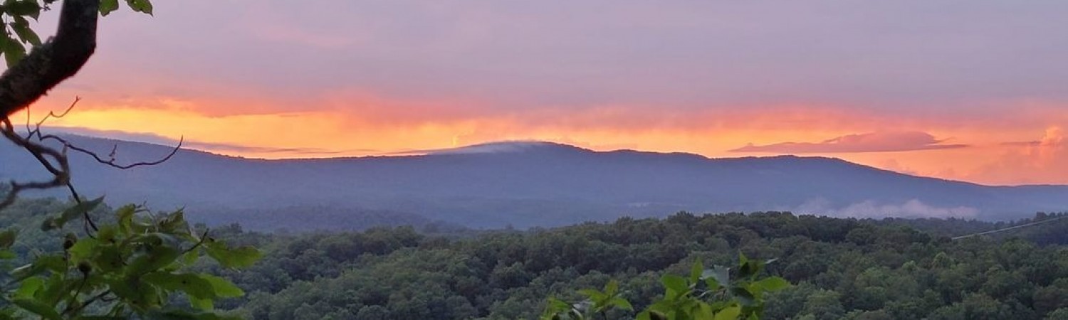
Forks of Cacapon and Fort Enoch The Forks of Cacapon community is one of the oldest settled tracts of land in this area. It is located between Slanesville and Bloomery on old West Virginia Route 45 - the piece left behind when Rt. 127 was constructed between Virginia Route 522 and WV Rt. 29, including a new bridge over the river. Locally this small, curvy stretch of road which includes a one-lane bridge is referred to as "the cut-through." The gravel road (Loy Rd on most maps) coming out of the Crossings meets this road in what was "downtown" Forks of Cacapon. The North River runs into the Cacapon River here at the "Forks." The first settlers were the Slains, Enochs, and the Largents. A gristmill was on Rt. 127 (then Braddock's Road) near the Powell property and was in use until 1920. It was run with a three-foot steel turbine wheel. Today, old grist mill wheels mark a driveway along the cut-through - perhaps from the old mill? James Powell also built an up and down sawmill with undershot water force sometime after 1832. George Washington surveyed the Enoch tract for Lord Fairfax in 1750 which comprises the Largent, Powell and Loy properties and included the land which became the Crossings. At that time, the settlers were still having skirmishes with the Indians and Enoch's fort was built for their protection. A runway was built from the fort to the river so the settlers could get to the water when the Indians were attacking. Timbers from the fort were still standing in 1835 but today only the rich black earth from the rotted timbers remains as a reminder of this fort. Fort Enoch was located on the Powell property (located on the "cut through") about 100 yards north of the family cemetery. It stood on level land not more than 20 yards from North River, but on a bank at least fifteen feet above the stream. The original stockade was constructed by Washington's troops during the winter of 1756, and we know it had been completed by early spring for on April 7th, Washington ordered Lt. John Blagg to proceed to Fort Edwards (at Capon Bridge) and to keep a communication open with Ensign Edward Hubbard who was in command at Enoch's. On April 17th, Washington ordered Captain John Mercer to take his company of the Virginia Regiment to Enoch's and to send out scouting parties as far as the Warm Springs (Berkeley Springs) to determine if any French and Indians were about. Captain Mercer was not destined to execute this order, for on April 18th, he engaged in a skirmish with the Indians near Fort Edwards where he and sixteen of his men were killed. Two men, one named Bowers and the other York, that went out from Fort Enoch to look about some crops planted nearby. They were suddenly attached by seven Indians. Bowers was killed, but York managed to reach the fort in safety. The Yorks and Bowers were neighbors of Enoch and they, together with numerous other settlers, sought the safety of this fort in time of danger. On April 20th, Washington learned that a great many settlers around the Forks desired to leave their cabins and farms because of the Indian menace. He then sent conditional orders to Ensign Hubbard to escort all settlers who desired to leave for Fort Edwards. Hubbard was also told to share the provisions in the Enoch stockade with any of the people needing food. On April 23rd, Washington specifically ordered Hubbard to vacate the place and retire to Fort Edwards. But the fort remained standing for on May 14, Washington directed the commanding officer of the militia to furnish a captain, two noncommissioned officers and 35 men to garrison Fort Enoch. The next day these orders were changed somewhat and Lieutenant Bebb, with two sergeants and 35 men were directed to Enoch's. On August 12th, Captain John McNeill and his company was ordered to Enoch's, and while there to surprise and waylay any Indians in the vicinity. McNeill was further instructed to send his men out on the mountains at night so that they might discover from the higher elevations the campfires of the enemy. On November 9th, Washington determined that 75 men were necessary to properly garrison Fort Enoch. Henry Enoch and the Forks of Cacapon first came into prominence in the spring of 1755 when his plantation was selected as one of the points through which Braddock's army was to march on its way to Fort Duquesne. During most of that year, the Forks of Cacapon was a bustling place, units of Braddock's army resting there on the march to the Monongahela and Dunbar's retreating troops passing through after the great defeat. Numerous military convoys stopped at Enoch's carrying supplies for Braddock's army and for Fort Cumberland. Being on the New Road from Winchester to Cumberland, the place continued to see much activity until 1766, when the Indian wars finally ceased and the garrison at Fort Cumberland was withdrawn. Washington was first at the Forks on April 21, 1750, when he surveyed land for Enoch as above noted. He was next there in the fall of 1753, when he used that route in carrying Governor Dinwiddie's message to the French on the Ohio. He was there with Braddock in 1755 on the march to Fort Cumberland, and he was at Enoch's several times thereafter, the last being on November 28, 1770, the fort mentioned as still standing. In May 1755, General Braddock established a ferry across the Great Cacapon just below the point where North River flows into the Cacapon. This ferry was continued in operation throughout the French and Indian War as a convenience for the Virginia and Maryland troops marching from time to time to and from Fort Cumberland. After the Indian troubles were over, the ferry was abandoned, but in 1792, it was again re-established by act of the General Assembly. By the end of the Revolutionary War, the New or Braddock Road was more or less abandoned as a highway to Cumberland and the west. As a consequence, the Forks of Cacapon neighborhood lapsed back into bucolic tranquility, its role in the early history of the frontier being now almost forgotten. John Loy was the last postmaster of the Forks of Capon Post Office when it closed in 1910. The building was later used as a general store; it stands in good repair on the cut-through. The Island Hill Methodist Church is on a hill overlooking this community. Caudy's Castle, a unique rock formation high over the river, is located in this community and is owned by local residents. The Forks today is still a quiet farming community; on weekends it is visited by many canoeists coming down the Cacapon River.
Bloomery Bear Garden, Diamond Ridge, Three Springs, High Top, Little Mountain, and Gobbler's Knob are the names of the mountains standing watch over one of the most beautiful and serene villages on earth - Bloomery, WV. Today, traveling east from Forks of Capon to the heart of Bloomery, you would see miles of woodland, green grass, flowering shrubs, and fields of wild turkey and deer grazing as they probably were hundreds of years ago; and in your mind you would be thinking, "Man and machines have never touched this place." You would be so wrong! It was over this road that Braddock's Army, accompanied by Lieutenant George Washington and Daniel Morgan as the wagoner, marched to disastrous defeat on that fateful trip to the Ohio Valley. After the death of Braddock, George Washington led the remnants of this defeated army back into Winchester over this same road, and so it is called Braddock's Road. The road remained the same until 1959 when a modern highway was constructed following the original with only minor deviations (present 127, taking the cut-through and proceeding north on Rt. 29 through Paw Paw to Cumberland and beyond). The stone for this road was taken from the land nearby. What was once considered "the picnic area," which many in the community hold in fond memory, is now called the "quarry." Why was the village named Bloomery? Not because of the many wildflowers that graced the countryside, but because it was a blooming, booming town. It could have been called an industrial city. The first evidence of the great works that went on here are the remains of the old iron furnace built in 1833 and now owned by George Johnson, presently visible from Rt. 127. The furnace's annual capacity was 8,500 tons of ore which was carried on rafts and flatboats down the Cacapon River. To make one ton of iron it took 800 pounds of limestone, 120 bushels of charcoal, and two and a half tons of iron ore. Iron ore and limestone were found in nearby mountains and the forest supplied the fuel. The pig was so called because the mold into which the iron was cast resembled suckling pigs fed by a sow. The iron was turned out every six hours. The furnace was first run by waterpower supplied by Bloomery Run and later a steam engine replaced this to operate the bellows. Several buildings were used in the operation, which included one for charcoal and limestone, a crusher, and also scales to weigh raw iron and iron ore. The ore was brought from the mines on trolley cars. With such a huge operation, this company employed approximately eighty men. The company store and school still remain across the road from the furnace, as well as two homes where some of the employees lived - none of which are presently occupied. The superintendent's house was torn down years ago. The school, though company owned, was open to the public and remained in operation until 1928. As you leave the furnace and travel east through Bloomery Gap the next operation was the Bloomery Flour Mill built by Samuel Foltz in the early 1800s. This was a wheat mill and farmers near and far brought their grain for grinding. In later years the Johnson family purchased the property from the Omps and the mill was used for grinding buckwheat. The waterwheel fell down in the early 1930s and was replaced by a gasoline engine which was used until 1936 when it was closed. Standing by Bloomery Run in good repair, the mill can be seen from the road. Many times during the Civil War, Bloomery was visited by raiding parties of Union and Confederate soldiers, and groceries, vegetables, and feed were hidden at the mill for safekeeping. A sumac mill (sumac was used for tanning and dyeing) stood on one side of the wheat mill with the waterwheel between. Two other gristmills were nearby but the remains (except for the raceways) have long disappeared. If you were in need of a new blanket or cloth for a suit of clothes your next step would be the stone woolen mill built by Col. Robert Sherrard in the 1800s and operated by him and his son until 1861. In this three-story building (including basement) were employed several people; looms occupied the entire second floor. A dyehouse was next to the mill. The mill closed in the fall of 1907, and the property was later sold. Two cabins now stand on this spot and were built from the remains of the stone foundations of the woolen mill. A sawmill up the run from the woolen mill was operated by Will Powell, who had an agreement with the owner of the woolen mill that the mill could have water rights ten months of the year and the sawmill two months - January and February. Other industries no longer remaining but very important included a boot shop, umbrella shop, and a tannery. The huge vats, six feet deep, were removed years ago, but the remains of a lime kiln stand along the road going east past the post office. Bloomery was settled in the latter part of the 1700s by the descendants of Yost Hite, who led the first settlement of thirteen families up the Shenandoah Valley to settle west of the Blue Ridge. The Hite family of Bloomery migrated from Strasburg, VA. They hold title to the first house built in Bloomery by Issac Hite, and it is still standing, though unoccupied. During the Civil War, a horse was hidden there from raiding parties of both sides. Water and feed were let down through an opening in the floor. Except for the last 30 years, most of the houses in Bloomery were built prior to the Civil War, with many interesting stories to tell. Bloomery holds claim to five original stone houses, all built with fieldstone, which includes the second house built by Issac Hite sometime around 1800. A number of interesting stories surround the houses and the community over the past 200 years; including sightings of ghosts, a hanging during the Civil War, pots of gold, lead mines (that few if any have actually seen), ginseng, bear caves up on the Cacapon, and even one home squeezed whiskey. The Issac Hite house is stone and was constructed so well it stands without any settling cracks. Also, it stood for a number of years without mortar in the joints. Issac Hite also built Belle Grove, just south of Winchester. Issac, or Mayor Hite, was active during the Revolutionary War and a close friend of George Washington. One interesting story concerning Issac Hite was that he built perhaps as many as a dozen houses between the valley and the Ohio River. The ownership of a large tract of land from Winchester to the Ohio River was the subject of a dispute between Issac and Lord Fairfax. The resulting lawsuits lasted almost fifty years. It is said that Hite built the houses not only because he owned the land but to help his case in the fifty-year legal battle with Lord Fairfax. The property owned by the Hites was mostly a cattle farm in the early nineteenth century and cattle were slaughtered and dragged on horse-drawn sled to Paw Paw where the railroad beds and tunnels for the B & O lines were being constructed. This sale of cattle helped pay for the "new addition." The house, according to today's roads, was built in a strange location, but the old maps show it to be located on the Pack Horse Trail, now completely overgrown in some parts. This road was used by the early pioneers as one of the main roads leading west to the Ohio Territory. It was customary in the early mid-nineteenth century for travelers on horseback to stop at roadside farms which sometimes doubled as inns, providing bed and board for a small fee. These stopovers gave the innkeeper a chance to catch up on the news from distant cities and the traveler an opportunity to hear what he might expect on the road. The Peacemaker family owns a beautiful nine-room stone house that was also a tavern. Although the date of construction, a deed shows a Mr. Yonely sold this house to Robert Rogers on July 5, 1836. One room, which has never been used by the Peacemakers, was the barroom located on the side of the house next to the bank. Another stone structure was a lodge built before 1882. A door with a deep hole, used for checking members, has since been closed. An interesting feature of this house is the huge rocks that form the foundation. A Dr. Hollis at one time had his office here and the Bloomery Brass Band practiced in this building. The story goes that the band had a picnic at Castle Rock (Caudy's Castle) and the bass horn and drum could be heard all the way to Bloomery, a distance of approximately three miles. It was also here that James Dignit shot a neighbor off his horse for cursing his mother. The man lived to tell it. Very near the old Bloomery Mill is perhaps Bloomery's most beautiful and interesting house, known as the Rodgers House or the Old Stone House. The mansion was built in the early 1800's with 20-inch-thick walls. It has four chimneys, each accommodating two fireplaces. In one of these still hangs the old cooking irons that were used in colonial days. The house also boasts hand carved mantels and window frames. Soft water is piped in from a never-failing spring a hundred yards above the house and reaches the second floor without the aid of a pump. Colonel Sherrard, the builder, was probably the largest slave owner in the area. How did Bloomery stand in the Civil War? Most of the settlers were Confederate with a few Union sympathizers. History books record the Bloomery Gap Skirmish which took place February 14, 1862, when Brigadier General Frederick W. Landers, commanding the Fifth and Eighth Ohio, Fourteenth Indiana Infantry, and 400 men of the first Western Virginia Calvary attacked the Confederate brigat of the Thirty-first, Fifty-first, Sixty-seventh, and Eighty-ninth Virginia Militia under Colonel J. Sencendiver. The Confederates were routed and fled toward Winchester. Landers returned to his camp at Paw Paw and Sencendiver again occupied Bloomery Gap. What history books didn't record was what the old-time people called "the Battle of Bloomery" as told by Paul Bradfield, whose grandfather, George Keiter, served in the War of 1812 and at one time owned over half of Bloomery. "It seems that approximately four hundred Confederate soldiers were camped up through Bloomery Gap and there was a gentleman by the name of Robert Sims, a Union sympathizer, who lived up on Diamond Ridge. He came out on the mountain that morning, carrying his rifle (he always had it with him because the Confederates tried to shoot him two or three times), and looked up through the valley. 'The sun was justa comin' up,' he says. 'And they was out thar with their little ole fires agoin'.' He just shot his rifle. Of course a bullet wouldn't carry but he just thought he'd fire anyhow. 'My golly,' he said, 'you never seed such a scuffling around in that valley,' he said. 'Directly the sun flashed,' he said again. He said, 'He knowed they were a trying to see whar the Union soldiers were up on the ridge with field glasses or telescopes, whatever they used, you know, the sun flashed on that.' Ole Sim says, 'I scrambled down behind them rocks, what I did," he said. "And I got out of there, what I did,' he said, "and I thoughted the next thing that would be acoming would be a cannon ball,' he said. 'What they would.'" Other skirmishes occurred with villagers taking potshots at both sides and there are many stories of sneak attacks and hanging trees during this period. Diamond Ridge is the name given to a mountain spur just west of the town of Bloomery (this is the mountain with the tower). Large rocks found here, the surfaces of which are studded with the most beautiful crystals, some of them an inch in diameter. From these, the ridge has taken its name. The fountain at Pin Oak is decorated with the crystals but visitors have chiseled many of them away. The crystals can also be found in Bath Hollow and are formed by the heat of the sun on sandstone. A school stood on this ridge at one time. The last session held in Bloomery School, which still stands on the David Hit property, was in 1954-55. Students now attend Slanesville Elementary, Capon Bridge Junior High, and Hampshire High Schools. The Methodists used this school for their worship services at one time and many picnics and cake walks were held there. The heart of Bloomery today is the Presbyterian Church, dedicated in 1825 as Bloomery Mills Presbyterian Church. Bloomery has had three general stores including the current Omps General Store and Shell gas station. Locals say the old stores used to have potbellied stoves and signs which read, "Please don't Spit on the floor." Today, Omps is our "local store" and well-patronized by Crossings residents.
The Crossings at the Great Cacapon Prior to the 1800's, the Largent family owned several thousand acres along the Cacapon River between the communities of Forks of Cacapon and the town of Largent (located on Rt. 9). In the early 1800's the Crossings land was owned and operated as a farm by the Hardy family. In the middle 1800's, the farm was sold to George W. Bowers and May Hardy Bowers. The blue farmhouse and barn near the gate were built about 1878 or 79. The stream that runs by the residence is named Bowers Run for the Bowers family. The founding families of Slanesville are ancestors of the Bowers family. In 1922, the present farm consisting of 1032 acres was bought by Orr D. Slane and Emma Bowers Slane, daughter in the Bowers family. In 1947, the farm (Capon View Farm) was sold by Emma Bowers Slane. Orr D. Slane died in 1937. Another parcel of land comprising the Crossings was the Nolan property, with similar history. John Mills, who owns the white house near Common Area 1 by the bridge, remembers coming to the farm and the cabin on the river with his grandfather John Bowers (same name but no relation to the Bowers who originally owned Capon View Farm). John Bowers and his brother-in-law Ralph Hoelzer rented the cabin from the Slane family and later David Shupe. When Patten Corporation began development plans, John asked if he could purchase his family's cabin; Patten agreed and so a small piece of the original farm remains in the family. One of the more recent owners of Capon View Farm was General David Shupe. He was known for being awarded the Congressional Medal of Honor at the Battle of Tarawa Island in World War Two and was later the Commandant of the Marine Corps. He also purchased the Nolan Farm, bringing the total owned land to approximately 1850 acres. At the farmhouse there used to be a small rental cabin prior to being torn down by the Patten Corporation in which General Shupe kept a few of his wartime mementoes. For many years, his overseer of Capon View Farm was Tom Shupe, who had the same last name but was not related. Tom Shupe tells us he kept cattle, up to 150 head at a time. In earlier times, sheep were raised there. He also said he’s had the fields growing just about everything at one time or another – corn, wheat, etc. At a recent gathering in the Crossings, Mr. Shupe reflected, "There's more cars parked here than we'd have seen in a year (less than ten!). My, I can't hardly believe how the place has changed. It's beautiful, though... still beautiful." Amen. That we have come to own a place so unspoiled, yet over which some of the most famous names and events in history have passed, is most certainly our good fortune. That we should love it, protect it, and deliver it unspoiled into the future is our providence.
Resources Resources used to create this story:
Additional Links: Historic Hampshire County, https://historichampshire.org/hamphist.htm Database of Hampshire County Names, https://historichampshire.org/data/person_search.php
Authors Darlene DeMott owned a house at The Crossings for many years, along with her husband Bill. Darlene was active in the community serving as Secretary and then President of The Crossings Board of Directors. Gary Hillmar’s grandmother was born in the farmhouse at the gate and Capon View Farm was their family homestead. Gary has been coming to what is now The Crossings for 75 years. He has written a history of the farm and family amounting to several hundred pages. |
|